The region is expected to rubber stamp Grand River Transit's service expansion plan for Cambridge this week for a Sept. 4 implementation.
The $1.5 million expansion will see changes that create a "simplified network that connects directly to major destinations, and expanded evening and weekend service."
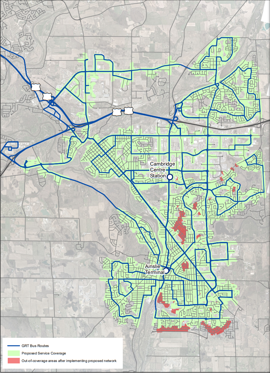
The revised transit network is designed to provide direct travel options between residential areas in east Galt, north Galt and Preston and major destinations like shopping centres, schools and employment areas without having to transfer at terminals.
More routes will connect directly to the Ainslie Street Terminal and the Cambridge Centre Station where connections to frequent routes such as the 302 ION bus are available.
Expanded service will also be coming to areas in southeast Galt near the planned recreation complex and Idea Exchange.
Staff project travel times for key trip segments on the new routes will decrease by five to 21 minutes.
Some respondents who provided feedback in response to proposed route changes last spring expressed concern about longer walking distances due to route streamlining.
Staff said they reviewed the feedback and refined the service plan further to address those concerns.
The service expansion will add 18,000 new service hours annually and at least 13,613 new trips. The expansion is expected to increase GRT's revenue by $292,000 annually.
The first phase of the expanded service will begin this September before the second phase is implemented next year upon approval in the 2024 regional budget.
The expansion is touted as a way to support current travel patterns and increase in long-term ridership in advance of Stage 2 ION LRT coming to Cambridge sometime within the next 10 years.