WEATHER ALERT
ENVIRONMENT CANADA
***************************
Freezing rain warning in effect for:
- Guelph - Erin - Southern Wellington County
- Kitchener - Cambridge - Region of Waterloo
Significant freezing rain expected Wednesday.
Hazards:
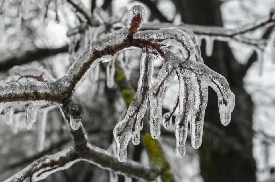
A prolonged period of freezing rain leading to significant ice build-up in some areas. Ice accretion of 5 to 10 millimetres is possible.
Snow and ice pellets, with total amounts of 5 to 10 cm.
Northeasterly winds gusting to near 50 km/h.
Timing:
Wednesday afternoon to early Thursday morning.
Discussion:
Light snow and ice pellets will become heavy at times late Wednesday afternoon into early Wednesday evening. Snow and ice pellets will mix with or change over to freezing rain Wednesday evening. Freezing rain will continue into the overnight on Wednesday before tapering off early Thursday morning to a risk of patchy freezing drizzle. Gusty northeasterly winds will diminish early Thursday morning.
Another light wintry mix of precipitation is possible Thursday afternoon into Thursday evening.
Surfaces such as highways, roads, walkways and parking lots will become icy, slippery and hazardous. Slow down driving in slippery conditions. Watch for taillights ahead and maintain a safe following distance. Beware of branches or electrical wires that could break under the weight of ice. Utility outages may occur. Public Safety Canada encourages everyone to make an emergency plan and get an emergency kit with drinking water, food, medicine, a first-aid kit and a flashlight. For information on emergency plans and kits go to getprepared.gc.ca.
Please continue to monitor alerts and forecasts issued by Environment Canada. To report severe weather, send an email to [email protected] or tweet reports using #ONStorm.
***************************


