A local severe weather expert is cautioning to take the upcoming storm seriously and to prepare for it.
Environment Canada has put out a blizzard warning for north Wellington County and a winter storm warning for Guelph and south Wellington County cautioning of a potential flash freeze, heavy snowfall and strong winds Friday into Saturday.
Similar warnings are in place for much of the province.
Mark Robinson, meteorologist and storm hunter for The Weather Network who lives in Guelph, said in an interview the storm hitting the province is absolutely enormous in size.
“It’s one of the biggest ones I think I’ve ever seen, especially at this time of year,” Robinson said.
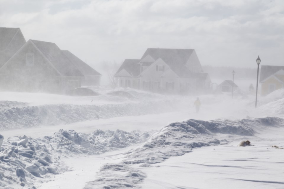
“You could have an extended period of hurricane force winds over top of Lake Erie or Lake Ontario and then 80 to 100 km an hour winds all over the rest of Southern Ontario.”
All this combined is adding up to dangerous travel conditions on Friday and Saturday coinciding with what are usually busy travel days for Christmas. Robinson said people might want to consider delaying Christmas celebrations for a day or two because of this.
“Don’t underestimate this one, I’d rather have people yell at me later for over-hyping it than (them) be stuck in a ditch somewhere and be in serious trouble,” Robinson said.
In Guelph and the surrounding area, Robinson said to expect around 20 cm of snow but it’s not the snow that will be the issue but the strong winds.
“You put that cold snow into the very strong winds and you end up with whiteout conditions and you end up with drifting snow on the roads,” Robinson said. “The plows keeping up with this stuff, they’re going to have some serious difficulties because even they can’t be out on the road if they can’t see the road itself and that’s going to be the big danger especially after dark.”
There’s also the potential for a flash freeze which Robinson said meteorologists are watching closely right now as it’s tricky to call as there’s potential for the water to dry.
“Don’t be totally surprised if yes it’s raining but you don’t see a lot of ice afterwards except on areas that there might have been some snow,” Robinson said.
“Your lawn may be totally frozen solid whereas the sidewalk might be dry.”
While most people will riding out the storm, Robinson will be in the thick of it chasing it for The Weather Network.
Robinson has been chasing storms for many years and said he’s loved the extremes of nature since he was a child.
When ranked in terms of chasing difficulty, Robinson said tornadoes are the most difficult because they’re rare and relatively fast but the weather tends to be warm.
“Whereas the winter storms, they’re easy to catch but man they’re difficult because you have to be fully dressed and fully done up and prepared for those conditions,” Robinson said.
For those who do have to head out during the storm, Robinson advised people to have an emergency kit in the car with extra food, water, blankets and winter gear, a fully charged phone and to generally take it easy on the roads.
“If you go in the ditch, it’s going to be hours before someone can get to you,” Robinson said.


